Avoid shutdowns and reduce downtime
At Perth Drone Centre, we deliver high-resolution aerial inspection services across Perth and Western Australia. Whether you’re monitoring infrastructure, assessing assets, or inspecting hard-to-access sites, we help you capture the data you need safely and efficiently.

Fast, Safe and Reliable Drone Inspections
Reduce risk, save time, and improve accuracy with our professional aerial inspection services.
We understand the challenges of inspecting large-scale, high-risk, or remote assets from metro Perth rooftops to WA’s regional infrastructure. That’s why we offer drone inspection services tailored to your site conditions, safety protocols, and reporting needs. All inspections are carried out by certified drone operators with extensive experience in technical CAD and spatial data.
Using industry-leading drone technology, we help you:
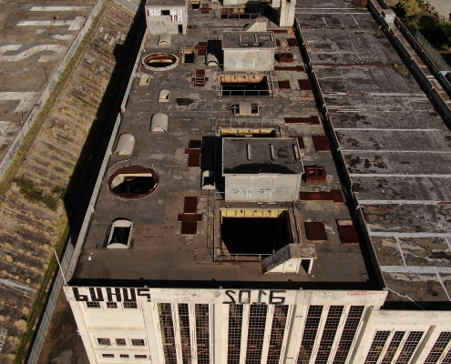
Roof Inspections
Capture clear overhead data without putting workers at risk. Our drone-based roof inspections provide high-resolution imagery and thermal data to detect damage, leaks, and structural issues quickly and cost-effectively.
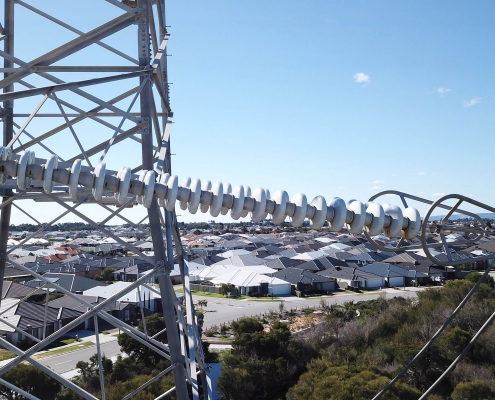
Utilities
Safely inspect powerlines, substations, wind farms, and solar installations. We help asset owners monitor performance, detect faults, and maintain compliance with minimal disruption.
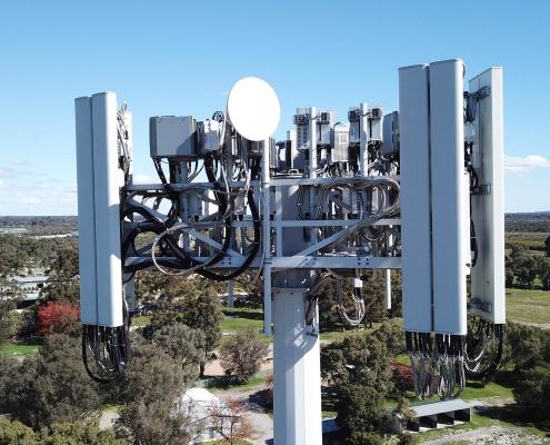
Telecommunications
Conduct inspections of mobile towers, antennas, and communication infrastructure without climbing or downtime. Our drones capture detailed visuals from every angle for maintenance planning and audits.
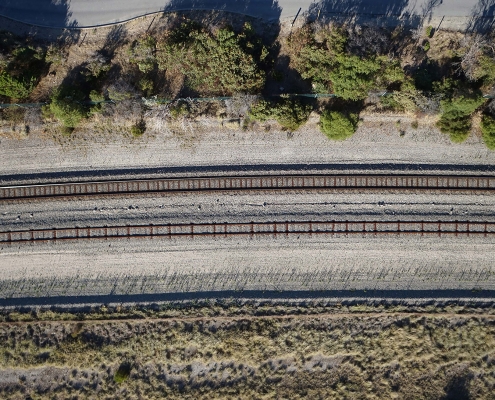
Infrastructure
Inspect bridges, tunnels, roadways, ports, and more with precision. We provide detailed, geo-referenced aerial data to support condition assessments, structural analysis, and ongoing asset management.
PERTH DRONE CENTRE
Perth Drone Centre’s Advantage in Aerial Inspections
We bring more than just flight capability. Our team combines CASA-certified drone operation with deep experience in CAD, spatial data, and asset-heavy environments. That means faster inspections, clearer outputs, and safer access to high-risk or remote areas.
You’ll benefit from:

FAQs
How accurate are your aerial inspections?
We use high-resolution cameras and LiDAR-compatible systems to ensure exceptional accuracy. Our team is trained in CAD and technical data capture, so you receive usable, detailed outputs every time.
What types of assets can you inspect?
We inspect rooftops, telecommunications towers, utilities, bridges, industrial plants, marine assets, and more. If it’s hard to reach or risky to access, drones are likely the safer, smarter option.
Are your drone pilots certified?
Yes. All inspections are conducted by licensed pilots operating under ReOC 1013. We are also fully insured and adhere to all aviation safety regulations.
Can you work in regional or remote locations?
Absolutely. We offer aerial inspection services across Western Australia, including the Pilbara, South West, and remote inland or coastal sites.
What happens if the weather is bad on inspection day?
For safety reasons, drone flights may be postponed in the case of heavy rain, strong winds, or poor visibility. We’ll work with you to reschedule promptly.
How quickly will I get the inspection data?
In most cases, we deliver processed outputs within 24–48 hours, depending on project scope and site access.


